Blank US Map: Printable Outline and Quiz
Print a blank map of the United States with state borders only, or a numbered quiz with an answer key on page 2.
Recent
Your last 10 settings, saved only in this browser. Nothing is uploaded.
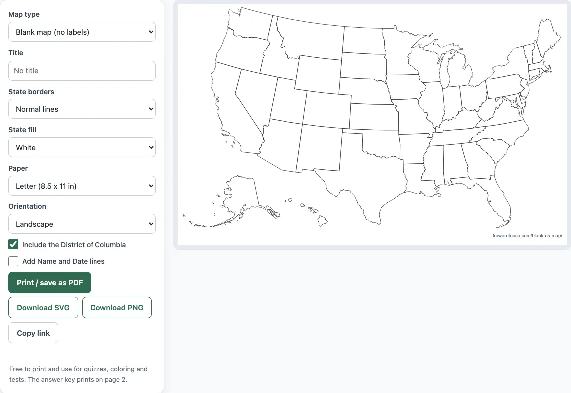
Blank US Map is a free tool that prints a blank map of the United States for quizzes, coloring and geography tests. It draws the 50 states and the District of Columbia with no text, so you can label them yourself or use the map for coloring. You can print the map, save it as a PDF, or download it as a PNG or SVG image. Everything runs in your browser, and nothing you type is sent anywhere. No sign-up is needed.
Teachers can print one copy per student; the numbered version comes with its own answer key.
Print as many copies as you need.
How to use the Blank US Map
- Open “Map type” and choose “Blank map (no labels)” for a plain map, “Numbered quiz + answer key” for a fill-in test, or “Blank map + abbreviations key” for a map with abbreviations. The default is “Blank map (no labels)”.
- Type a heading in “Title” if you want one. It is empty by default.
- Choose a line weight in “State borders”: “Thin lines”, “Normal lines” or “Bold lines”. Pick “Bold lines” for young children.
- Choose “State fill”: “White” or “Light gray”.
- Choose “Paper”: “Letter (8.5 x 11 in)” or “A4”. Then choose “Orientation”: “Landscape” or “Portrait”.
- Keep “Include the District of Columbia” ticked to show DC, or untick it to leave DC out. Tick “Add Name and Date lines” to print those lines above the map on page 1.
- Click “Print / save as PDF”. In the print dialog, set the scale to 100%.
Use “Download PNG” or “Download SVG” for an image file. “Copy link” gives you a link that keeps your chosen settings. The answer key prints on page 2, so you can hand out page 1 alone. This map can be printed, shared and used for any purpose, including classroom use and products for sale, royalty-free and without credit.
Where can I get a blank map of the US to print?
You can print one from this page. Set the controls you want and click “Print / save as PDF”, so you do not need to download a file first. The map is drawn to fit the paper you choose, either Letter (8.5 x 11 in) or A4, with 10 mm of padding around it. Set the print dialog to 100% scale so the map keeps its correct size.
Is there a numbered blank US map with an answer key?
Yes. Choose “Numbered quiz + answer key” in “Map type”. Each area gets a number from 1 to 51 at its label point. The numbers follow alphabetical order by state name, so Alabama is 1, Alaska is 2, and Wyoming is 51. The nine small north-eastern units have their numbers in boxes on the right, joined to their shapes by leader lines. Students write the state name next to each number, which makes the sheet a fill-in-the-blank test. Page 2 is titled “Answer key” and lists the numbers with state names in three columns.
Can I get it as a PDF?
Yes. Click “Print / save as PDF” and choose “Save as PDF” as the printer in your browser’s print dialog. The file uses the paper size, orientation and options you set. If you chose a numbered map, the answer key is saved on page 2.
Can I get it as an image?
Yes. “Download PNG” gives you a raster image, and “Download SVG” gives you a vector file that stays sharp at any size. Both files contain page 1 only, which is the map without the answer key.
Does the blank map show state borders?
Yes. The blank map draws the border of each state, and those borders are the only lines the tool draws. It does not draw one outline around the whole country. Choose “Thin lines”, “Normal lines” or “Bold lines” in “State borders” to set the line weight. For the fill, “White” leaves the states unprinted, and “Light gray” applies a light tint so the shapes stand out from the page.
Does it include DC?
Yes, by default. The District of Columbia appears as a small marker on the blank map and receives its own number in the numbered quiz. Untick “Include the District of Columbia” to leave it out. In that case DC is grayed out and does not get a number.
What is the difference from the printable labeled map?
This tool is built for quizzes, coloring and tests. It gives you an empty map or a numbered one that students fill in. The printable labeled map instead prints names, abbreviations or capitals on the states, so it works as a reference. If you want abbreviations on this map, choose “Blank map + abbreviations key”. Page 2 then shows the same map with two-letter abbreviations and an alphabetical list.
Frequently asked questions
Can I use the printable map for commercial purposes or sell printables in an online shop?
Yes. Maps made with this tool can be printed, shared and used for any purpose, including classroom use and products for sale. The use is royalty-free and does not need credit. The only limit is that you may not copy the website or tool as a competing service.
Is the map free to use?
Yes. It is free to print and use for quizzes, coloring and tests. You do not need to sign up.
Is my data sent anywhere when I make a map?
No. Everything is made in your browser, and nothing is uploaded.
Are Alaska and Hawaii shown to scale?
No. Alaska and Hawaii are insets placed beside the main map, and they are not to scale. The outlines come from the US Census Bureau TIGERweb Generalized ACS 2025 data, fetched 2026-07-28, and the map uses the Albers USA projection.
Do the Name and Date lines appear in the image files?
No. The Name and Date lines print above the map on page 1 only. They are not included in “Download SVG” or “Download PNG”.
Why is there no outline around the whole country?
Drawing one outline for the whole country would require merging the state shapes, and this tool does not do that. Only the state borders are drawn.
What paper size should I choose?
Choose “Letter (8.5 x 11 in)” for US paper, which measures 215.9 x 279.4 mm, or “A4” for paper that measures 210 x 297 mm. The map keeps 10 mm of padding on every side. Set the print dialog to 100% scale so the map prints at the correct size.
Related tools
- States visited map: Use this when you want to mark the states you have been to.
- Printable US map: Use this when you need a US map for handouts or reference sheets.
- National parks map: Use this when you want to see where the national parks are located.
- National parks checklist: Use this when you want a list to tick off as you visit parks.
- Travel itinerary template: Use this when you are planning the days and stops of a trip.